Abstract
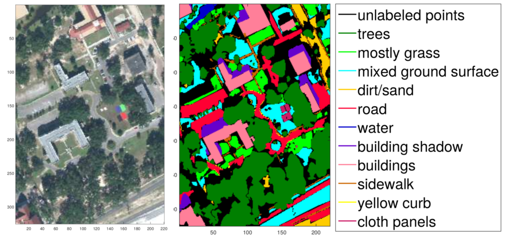
This report presents the documentation of the ground truth map for MUUFL Gulfport data set campus 1 scene, provided by manually labeling the pixels in the scene into trees, mostly-grass ground surface, mixed ground surface, dirt and sand, road, water, buildings, shadow of buildings, sidewalk, yellow curb, cloth panels (targets), and unlabeled points. This report also provides plots of each sub-class labels and explains information contained in the MATLAB structure.
Links
Zenodo
PDF
GitHub (MUUFL Gulfport complete data set)
GitHub (MUUFL Gulfport scene label map)
UF News
Citation
Plain Text:
X. Du and A. Zare, “Technical Report: Scene Label Ground Truth Map for MUUFL Gulfport Data Set,” University of Florida, Gainesville, FL, Tech. Rep. 20170417, Apr. 2017. Available: http://ufdc.ufl.edu/IR00009711/00001.
BibTeX:
@TECHREPORT{du2017technical,
Title = {Technical Report: Scene Label Ground Truth Map for MUUFL Gulfport Data Set},
Author = {Du, Xiaoxiao and Zare, Alina},
Year = {2017},
Month = {Apr.},
Number = {Tech. Rep. 20170417},
Institution = {University of Florida},
Address = {Gainesville, FL},
URL = {http://ufdc.ufl.edu/IR00009711/00001}}